METIS-OC, the OC component of Monitoring & Evaluation of Thematic Information from Space (METIS),
provides near-real time critical diagnostics of EUMETSAT operational level-2 (L2) Ocean Colour products.
Current Satellite OC Products monitored in METIS-OC are from: Sentinel-3A OLCI, Sentinel-3B OLCI
All analyses are based on OLCI Level2 Collection 3 data. They are stratified based on different levels of pigment concentration into
9 Regions of interest (ROI). (Some regions of optically-complex waters e.g. Río de la Plata still not included in any of the considered ROIs)
They are computed from 9km global binned level3, including BRDF correction according to Morel 2002 and Wang 2006.
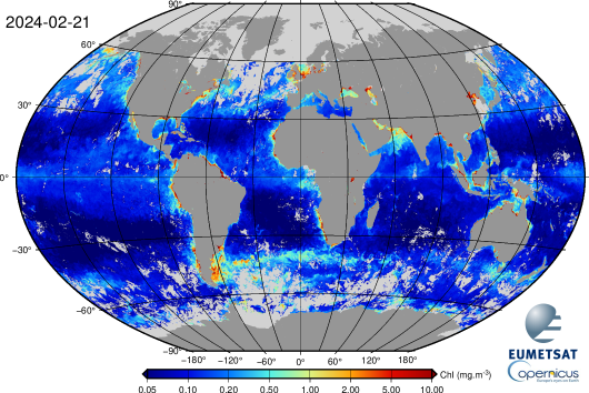
Latest available Sentinel-3A OLCI Chlorophyll map:
 8 Days, Sentinel-3A OLCI OC (click on image to enlarge). For more maps, click here.
Ocean Colour, ρwN 442.5nm, Deep (>=1000m)
8 Days binned mean monitoring of satellite Ocean Colour. For more time-series, click here.

